Rivash, Iran
Rivash
Persian: ريوش | |
|---|---|
City | |
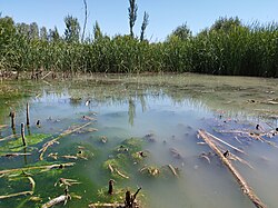
 Rivash in 2022 | |
| Coordinates: 35°28′31″N 58°27′33″E / 35.47528°N 58.45917°E[1] | |
| Country | Iran |
| Province | Razavi Khorasan |
| County | Kuhsorkh |
| District | Central |
| Population (2016)[2] | |
| • Total | 5,687 |
| Time zone | UTC+3:30 (IRST) |
| Website | rivashi |
| Rivash, Iran at GEOnet Names Server | |
Rivash (Persian: ريوش)[a] is a city in the Central District of Kuhsorkh County, Razavi Khorasan province, Iran, serving as capital of both the county and the district.[4] As a village, it was the capital of Barkuh Rural District[5] until its capital was transferred to the village of Ivar.[4]
History
[edit]According to the evidence, this area was inhabited before the advent of Islam, and due to the fact that the old road of the southern cities of Razavi Khorasan to Tehran passed through this area, it has been more prosperous in the past. One of the most important historical events is the Mongol invasion, which after the occupation of Nishapur, due to its impassability and the large number of snakes in the area, Mongol horses and soldiers could not pass through this area and escaped its bite.
The village of Rivash was elevated to the status of a city in 1999.[6]
Demographics
[edit]Population
[edit]At the time of the 2006 National Census, the city's population was 4,610 in 1,277 households,[7] when it was capital of the former Kuhsorkh District of Kashmar County.[8] The following census in 2011 counted 5,762 people in 1,597 households.[9] The 2016 census measured the population of the city as 5,687 people in 1,701 households.[2]
In 2018, the district was separated from the county in the establishment of Kuhsorkh County, and Rivash was transferred to the new Central District as the county's capital.[4]
Climate
[edit]The climate of Rivash, is temperate and due to its lush nature, vegetation, dense trees, river, south and west of the city, it has a cool climate in summers and very cold winters. The average annual temperature is 25 degrees.
Historical sites, ancient artifacts and tourism
[edit]
Shahi Dam
[edit]Shahi Dam was built about 700 to 1000 years ago and located in Kariz, Kuhsorkh County.[10][11]
Band-e Qara Bathhouse
[edit]Band-e Qara Bathhouse is a historical Public bathing related to the Qajar dynasty and is located in Band-e Qara, Razavi Khorasan Province.[12]
Band-e Qara Glacier
[edit]Band-e Qara Glacier is a Glacier is located in Band-e Qara, Razavi Khorasan Province.[13][14]
Baghdasht Peak
[edit]Baghdasht mountain range, the largest peak of which is 2500 meters above sea level, is part of the Rivash heights and is located near the village of Kariz, 25 km northwest of Kashmar.[15]

Qal'eh Dokhtar, Kuhsorkh
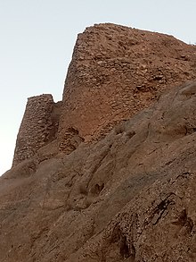
[edit]Qal'eh Dokhtar is a historical castle located in Kuhsorkh County in Razavi Khorasan Province, The longevity of this fortress dates back to the Nizari Ismaili state.[16][17]
Gabar Hesar Castle
[edit]Gabar Hesar Castle is a Castle related to the second century AH and is located in the Kuhsorkh County.[18]
Nameq Village
[edit]Nameq is located in a hilly area and many mountains surround the village. It has many historical sites, for example, the tomb of the great Gnostic Sheikh Abol Hassan (father of Sheikh Ahmad-e Jami) is located 500 metres (1,600 ft) away from the village in a green plain. In addition, there are the remains of an ancient castle, pre-Islamic and post-Islamic cemeteries, a citadel, mosques and other beautiful pieces of architecture.[19][20]
Nameq Cemetery
[edit]The Nameq Cemetery is a historical cemetery related to the Safavid dynasty and is located in Nameq.[21]
Nameq Castle
[edit]Nameq Castle is a historical castle located in Nameq in Razavi Khorasan Province, The longevity of this fortress dates back to the Before the Mongol conquest.[22]
See also
[edit]Notes
[edit]References
[edit]- ^ OpenStreetMap contributors (2 November 2024). "Rivash, Kuhsorkh County" (Map). OpenStreetMap (in Persian). Retrieved 2 November 2024.
- ^ a b Census of the Islamic Republic of Iran, 1395 (2016): Razavi Khorasan Province. amar.org.ir (Report) (in Persian). The Statistical Center of Iran. Archived from the original (Excel) on 2 April 2022. Retrieved 19 December 2022.
- ^ Rivash, Iran can be found at GEOnet Names Server, at this link, by opening the Advanced Search box, entering "-3081201" in the "Unique Feature Id" form, and clicking on "Search Database".
- ^ a b c "Notification of the establishment of Kuhsorkh County in Razavi Khorasan province". cabinetoffice.ir (in Persian). Ministry of the Interior, Board of Ministers. 23 December 2018 [Approved 20 September 2018]. Letter 56248/120511. Archived from the original on 25 October 2022. Retrieved 1 May 2023 – via Political-Defense Commission of the Government Board.
- ^ Creation and formation of 10 rural districts including villages, farms and places in Kashmar County under Khorasan province. rc.majlis.ir (Report) (in Persian). Ministry of the Interior, Board of Ministers. 13 September 1395 [Approved 4 October 1366]. Proposal 53.1.11934; Notification 116638/T881. Archived from the original on 3 September 2016. Retrieved 6 January 2024 – via Islamic Parliament Research Center.
- ^ Habibi, Hassan (15 March 2014) [Approved 20 July 1378]. Reforms in the national divisions of Khorasan province. rc.majlis.ir (Report) (in Persian). Ministry of the Interior, Defense Political Commission of the Government Board. Proposal 1.4.42.18449; Notification 11599/T20944K. Archived from the original on 4 March 2016. Retrieved 2 November 2024 – via Islamic Parliament Research Center of the Islamic Republic of Iran.
- ^ Census of the Islamic Republic of Iran, 1385 (2006): Razavi Khorasan Province. amar.org.ir (Report) (in Persian). The Statistical Center of Iran. Archived from the original (Excel) on 20 September 2011. Retrieved 25 September 2022.
- ^ Habibi, Hassan (c. 2015) [Approved 21 June 1369]. Approval of the organization and chain of citizenship of the elements and units of the divisions of Khorasan province, centered in Mashhad. rc.majlis.ir (Report) (in Persian). Ministry of the Interior, Defense Political Commission of the Government Council. Proposal 3223.1.5.53; Approval Letter 3808-907; Notification 84902/T125K. Archived from the original on 17 November 2015. Retrieved 6 January 2024 – via Islamic Parliament Research Center.
- ^ Census of the Islamic Republic of Iran, 1390 (2011): Razavi Khorasan Province. irandataportal.syr.edu (Report) (in Persian). The Statistical Center of Iran. Archived from the original (Excel) on 20 January 2023. Retrieved 19 December 2022 – via Iran Data Portal, Syracuse University.
- ^ "Shahi Dam". IRIB NEWS AGENCY. Retrieved 25 October 2020.
- ^ "Shahi Dam". Mizan Online News Agency. Retrieved 25 October 2020.
- ^ "فهرست آثار ثبتی - اداره میراث فرهنگی شهرستان کاشمر". kashmar.razavichto.ir. Retrieved 10 March 2021.
- ^ "یخچال طبیعی بند قرا". seeiran.ir. Retrieved 11 March 2021.
- ^ "یخچال طبیعی بند قراء". kashmar.razavichto.ir. Retrieved 11 March 2021.
- ^ "معرفی برنامه قله باغدشت کاشمر". kavianclub.com. Retrieved 24 October 2020.
- ^ "قلعه دختر". www.taher117.blogfa.com. Retrieved 19 February 2021.
- ^ "قلعه پسر و قلعه دختر". 4iranian.com. Retrieved 19 February 2021.
- ^ "قلعه گبر حصار". seeiran.ir. Retrieved 13 November 2020.
- ^ "Namaq Village". www.itto.org. Retrieved 24 October 2020.
- ^ "روستای تاریخی نامِق". khorasan.iqna.ir. Retrieved 24 October 2020.
- ^ "روستای تاریخی نامِق". khorasan.iqna.ir. Retrieved 20 March 2021.
- ^ "قلعه قدیمی روستا". namaq-village.ir. Retrieved 20 March 2021.


